Quality items from Bonanza’s top-rated sellers.
ThisandThat7788's booth earned a 100% satisfaction rating for providing an excellent experience from start to finish. View booth >>


| Category: | |
|---|---|
| Quantity Available: |
Only one in stock, order soon |
| Condition: |
Unspecified by seller, may be new. |
| Type: |
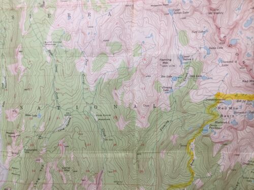
Anthropomorphic Map |
| Maker: |
USGS |
| Original/Reproduction: |
Antique Original |
| Date Range: |
1960-1969 |
| Year: |
1953 |
| Country/Region: |
United States of America |
| US State: |
California |
| Mexican State: |
Nayarit |
| Format: |
Sheet Map |
| Printing Technique: |
Lithography |
| Cartographer/Publisher: |
Geological Survey Control |
| Feature Refinement: |
True Vintage Map |
| City: |
Black Cap Mountain |
| Publication Year: |
1962 |
| Canadian Province: |
N/A |
| Topic: |
Maps |
| Original Reproduction Reprint: |
Original |
| Seller policies: | |
|---|---|
| Shipping discount: |
Shipping weights of all items added together for savings. |
| Posted for sale: |
May 13 |
| Item number: |
1746847645 |
We'll email you a link to your item now and follow up with a single reminder (if you'd like one). That's it! No spam, no hassle.